DMSmart Technologies

Laser Scanning

● 2D Drawings
● 3D Models
● Revit models

Lidar Services

● LiDAR stands for Light Detection and Ranging.

Photogrammetry

● Photogrammetry is used to extract meaningful object and environment

Data Conversion

● Map Data creation
● Utility Mapping
● Contour Mapping
● Topographic Mapping
● Mapping of Parcel

Building Information Modelling

● Architectural
● Cultural heritage
● Industrial process Plant
● Airport Modelling
● Hospitals
● Schools

Mobile Mapping

● Lidar Classification
● Digital Terrain Models
● Surface and Sub station Modelling

Land Administration Industries

Our spatial data solutions have assisted clients with a broad range of land management functions.

Architectural Engineering and Construction

By using the latest GIS technologies to enhance productivity, mitigate risks, and ensure real-time

Transmission & Distribution Network

Powerline Data services aid in accurately analysing the results from survey of transmission

Process Plant Engineering

We empower our customers with intelligent data models and significant insights into the PPE sector

Our Core Values

Integrity

We believe open and honest relationships with our customers and our employees are the only way to do business

Collaboration

We are community of business professionals providing both global and local perspective, we share ideas and work together to meet our business objectives.

Quality

Engage right people with the right experience and delivery best in class services to our trusted clients

Innovation

We foster creativity and adaptability, to consistently explore new way of delivering value.

Recognition

We believe in recognizing the involvement of our people. We support, encourage, celebrate their contributions

Geographic Information Systems

GIS Modelling Services

● 2D Drawing
● Autocad Modelling
● Revit Modelling
● Architectural Modelling
● Structural Modelling
● Oil and Gas modelling
● Terrestrial modelling
● Sub-station and Surface Modelling
● BIM Modelling
● DEM (Digital Elevation Model)
● DTM (Digital Terrain Model)
● DSM (Digital Surface Model)

GIS Mapping Services

● Topographic Mapping
● Utility Mapping
● Contour Mapping
● Parcel Mapping
● Planimetric Mapping
● Cadastral Mapping
● Mobile Mapping

Pross Flow

Case Studies

Process Layout: Skids

  • Brief Scope: To create a 3dModel
  • Input : 3d Point cloud data.
  • Output : 3d CAD Model
  • Duration : 900 Man-Hours
  • Team Size: 8
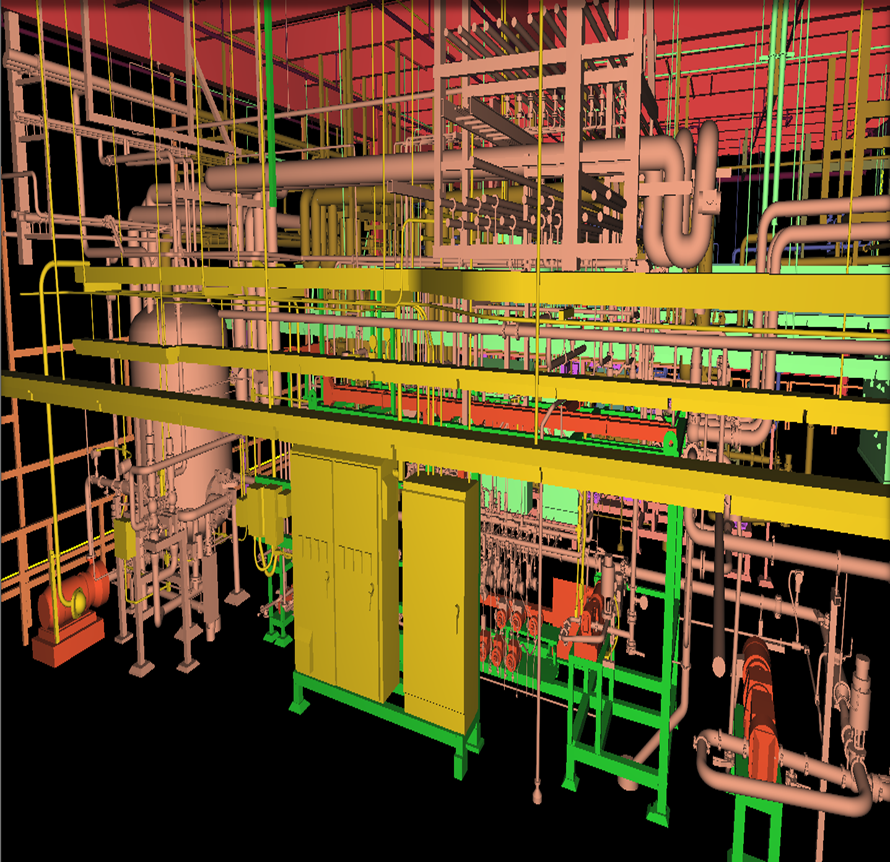
  • CHALLENGES:  The main challenge is to model the Heavy dense Pipe lines and the flow-meters, valves, evacuators and clamps.

Industrial Layout : Process Plants

  • Brief Scope: To create a 3dModel
  • Input : 3d Point cloud data.
  • Output : 3d CAD & INVENTOR Dump Model
  • Duration : 450 Man-Hours
  • Team Size: 5
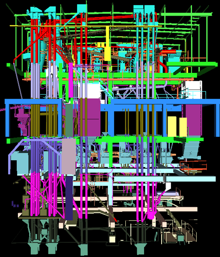
  • CHALLENGES: The main challenge is to model the intricate shapes of the equipment’s and inter link the equipment flow and Piping flow from Floor to Floor.

Shipbuilding

  • Brief Scope: To create a 3d as built Model
  • Input : 3d Point cloud data & Photos.
  • Output : 3d CAD model & PDMS Dump Model
  • Duration : 250 Man-Hours.
  • Team Size: 5.
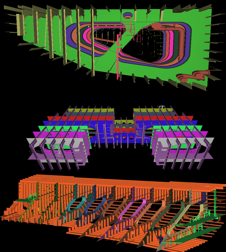
  • CHALLENGES: The quite challenging in this model is the stiffeners and outer shapes of the Ballast tanks. Due to the 3D structure of the ship.

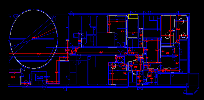
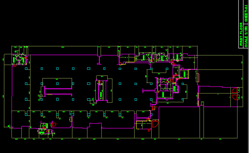
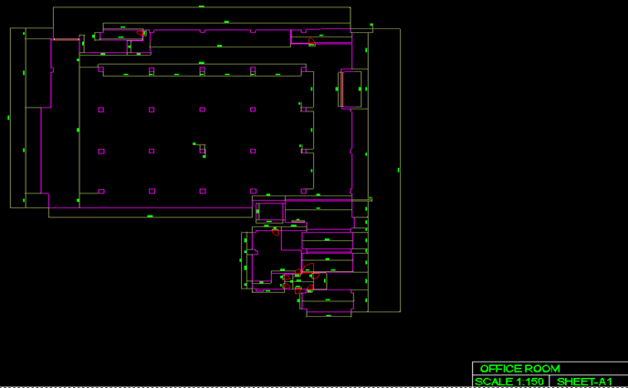
Architectural Modeling

  • Brief Scope: To create a 3dModel & 2D Plans
  • Input : 3d Point cloud data.
  • Output : 3d CAD Model & 2D Plans
  • Duration : 700 Man-Hours
  • Team Size: 16
  • CHALLENGES: The main challenge is to create the front elevation shape and the Doom shape of this building.

2D PLANS

Secured By miniOrange